Monteverde and Costa Rica Weather
Weekly trend
From October 1st to 7th, 2018
General Review
This week is forecast rainy in the national territory, due to several atmospheric factors; mainly because the Intertropical Convergence Zone will be very active on the country generating abundant rainfall in a large part of the national territory.
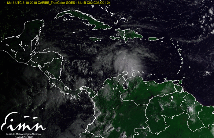


At the same time, the tropical wave # 39 will cross Central America tomorrow, reinforcing the showers of the afternoon and the rains of variable intensity at night.
It is expected that Wednesday and Thursday are the rainiest of this week, and that the heaviest rains will be concentrated in the Central Pacific, South Pacific and North Zone regions; in addition to the mountainous sectors of the Caribbean.
Forecast
Morning: Partly cloudy on Mondays and Tuesdays; in addition to Saturday and Sunday. As of Wednesday, there will be a predominance of clouds in the Pacific Slope and the Central Valley, with a probability of rain in the Central Pacific and the South Pacific.
Afternoon: Mostly cloudy throughout the country with isolated showers accompanied by an electrical storm.
Nights: Isolated rains in the center of the country and near the Pacific coast, as well as plains in the North Zone, mainly on Wednesdays and Fridays.
Temperature extremes in climatic regions of the country
REGION
TEMP MAX °C
TEMP MIN °C
Central Valley 30 14
North Pacific 34 18
Central Pacific 33 16
South Pacific 33 16
Caribbean 31 18
North Zone 32 16